The National Hurricane Center projects Hurricane Florence will make landfall in Wilmington, North Carolina early Friday morning.
The Category 4 hurricane is expected to downgrade to a Category 3 storm before striking the coast and moving inland, affecting the states of North Carolina, South Carolina and Virginia the most.
“We are anticipating some significant and possibly life-threatening impacts across North Carolina,” said James Morrow, a meteorologist with the National Weather Service (NWS).
Once on land the hurricane is predicted to stall over the eastern part of the Carolinas and will then track further south. This stalling will likely result in heavy flooding throughout the region.
“As it comes on land, it actually impacts a frictional surface and begins to weaken rather quickly and actually slows its progress,” Morrow said.
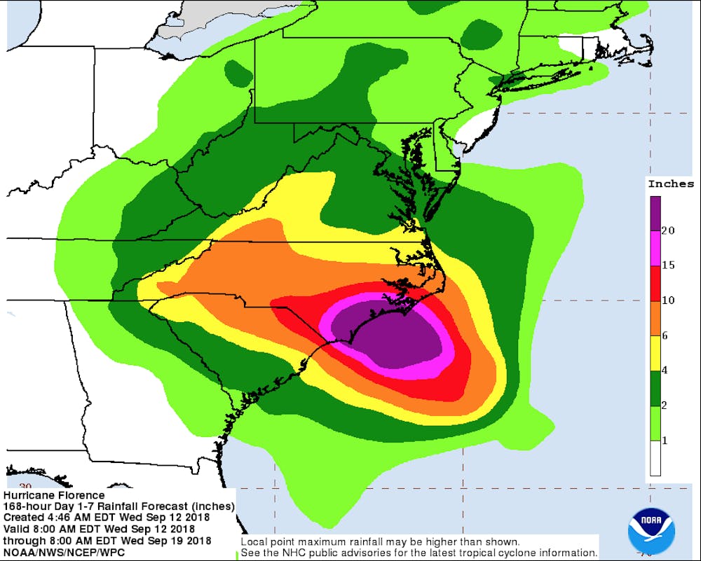
Current models from the National Oceanic Atmospheric Administration (NOAA) show the storm dropping anywhere from 6 to 10 inches of rain on the Town of Elon. A relatively small amount when compared to Wilmington, which is currently expecting more than 20 inches of rain over the next week.
Derek Dzinich, an Elon University junior has worked with NOAA over the last four years and trusts in the forecasts from the NWS, which is encompassed by NOAA.
“NOAA is the most well-developed weather tracker in the country,” Dzinich said. “Not only do they have the best equipment, they also have forecasting branches all over the country. That’s how they are able to so consistently track a single storm.”
Even though all of NOAA’s data points towards Hurricane Florence’s wind speeds subsiding before reaching Elon, both Morrow and Dzinich stressed the importance of being prepared for this storm.